Posts

Showing posts from February, 2023

Time to Recharge the Batteries

Image
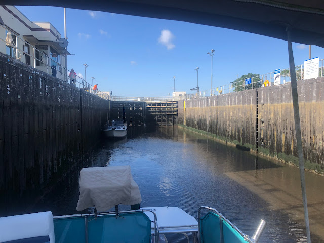
  TRAVEL DAY 9 - Stuart to Ft. Pierce February 24, 2023 3.65 Hours/26.6 Miles     We pulled out of our third nice anchorage. Had it not been for another Looper, we wouldn't have know about this gem. We have come to rely so much on the Looper community. We meet more and more Looping travelers everyday, each one with their own stories of where they're from and what they've seen. NEBO has also been a fantastic cruising device. The little transponder mounted under the dash of the flybridge automatically records each journey and at the end of the day sends us a report with all of the stats, a map, the weather along the way and gps locations of each part of the trip. It has made my log entries even easier as all I really keep track of are engine hours, fuel usage, pump outs and marina stays.      We are starting to find that traveling during the week and staying put on the weekends when the boat traffic increases is the best. The added bonus is that there tend to be more events a

Locks and Bridges

Image
  TRAVEL DAY 8 - St. Lucie Lock to Stuart February 23, 2023 4.1 Hours/19.7 Miles     The last Lock! This one was a 13' drop. On the other side, back to currents and tides. Return to the brackish and then the salt water. We had to revert back to spring lines and current change anchor swings instead of the lazy waters of the river. 13' drop to the St. Lucie River     We cruised toward Stuart with our intended goal of tying up to the Stuart Riverside Pier, have lunch and explore some of their riverwalk. We reached the Roosevelt Bridge outside of Sunset Bay Marina at 10:18 am and got in line holding position in the mild current until the next opening. The 12' vertical clearance bridge and more importantly the 7' vertical clearance of the railroad bridge have to both open in order to transit. Both open every 1/2 hour. As soon as we could see the car traffic halt on both sides, the railroad bridge began to swing open first and when it had fully opened, the horn sounded and th

Across Okeechobee

Image
  TRAVEL DAY 7 - Clewiston to St. Lucie Lock February 22, 2023 6.4 Hours/49.5 Miles     Every day is a planning session that continues throughout the day evolving as the scenery and conditions evolve. What time to leave, where to go, where to stop, where do we get fuel, where do we pump out, can we dock there, should we go to a marina, should we anchor out, what's the weather, and on and on. It may sound like it takes all the fun out of the trip but it doesn't. What it has done is teach us to be resilient and not complacent. To be ready for change and to adapt. It's half vacation, half military mission and still an amazing amount of fun. We are learning to live with each other and work together. We have a new phrase "Getting smarter everyday!".  Roland Martin Marina     Today we left our side tie berth with another boat "Irish Hurricane" to travel a couple hundred feet to the lock that got us in to the basin and Roland Martin Marina. Irish Hurricane had

Another Great Anchorage

Image
  TRAVEL DAY 4 - Cabbage Key to Cape Coral February 19, 2023 3.3 Hours/26.8 Miles     We pulled out of Cabbage Key at a little past 9 am and headed to Cape Coral/Fort Meyers. This was by far one of the prettiest days yet, with little wind and mild temperatures. We untied, chugged out of the basin, turned to the south and headed out. As we turned east we entered "The Miserable Mile". Appropriately named since it is narrow, has quite a strong cross current at times and is absolutely littered with boats. We were traveling on a Sunday and since the weather was fantastic the number of boats coming at us was incredible, I felt like a Salmon swimming upstream. I've only seen this many boats on the first day of Scallop Season!     We pushed our way through the gauntlet of boats and made our turn to an anchorage in Cape Coral called Bimini Basin. The approach was simple but the last marker showed us less than 4' of water. It was low tide and I pulled the boat out of gear and d