TRAVEL DAY 149 - Orange Beach to Big Sabine, FL
November 24, 2023
4.42 Hours/ 35.2 Miles
A cold day after Thanksgiving but clear as a bell and very little breeze. We rolled up the power cord & started the engine. The captain in the next slip helped us with our lines, and with a thick Alabama accent said "Y'all have a good trip."
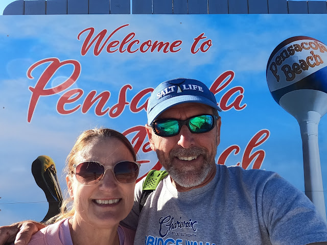 |
| Pensacola Beach |
Today would be the last day with our longtime traveling companions Runaway. Pau Hana would be making a push to get to Carrabelle and an acceptable weather window to cross the Gulf to Crystal River by next weekend.
 |
| Passing a tow |
By 10 am we were officially in Florida and the Dolphins came to greet us. To us, there is nothing like the Gulf Coast and today was an exceptional cruising day. We thought we were done with tows but up ahead at Dolphin Pass was a tug pushing 2 barges of fuel. I hailed him on channel 13 and got the directive to pass on the 2 as soon as he cleared the corner, and we did,
 |
| A Dolphin Escort |
We passed Fort McRee then Fort Pickens, both constructed after the War of 1812 to strengthen defenses at Pensacola Bay. Making our way a little father east, we made a turn to starboard and in to our anchorage on the Intracoastal side of Pensacola Beach. The deck crew dropped the anchor and I backed down on it to set it in the hard bottom.
 |
| Big Sabine Anchorage |
 |
| Green Glass Water |
We deployed the dinghy and ran it up to the shoreline so that we could walk over the dunes and onto Pensacola Beach. The water was a beautiful green Coca-Cola bottle glass color, and we enjoyed sitting on the sugar sand. That evening we had a goodbye toast with the the River Rats, knowing we would see them when they came into Crystal River.
 |
| Orange Beach to Pensacola Beach |
TRAVEL DAY 150 - Pensacola Beach to Destin
November 25, 2023
4.75 Hours/ 34.1 Miles
Sadly we left the last River Rats in the Pensacola Beach anchorage and continued on toward Destin. A beautiful cool and a little breezy start to the day, I followed our track back out of the anchorage and into the ICW. We traveled along with the 40 mile long Santa Rosa Island to our starboard.
 |
| Eglin Air Force Base Tower |
We passed Navarre Beach, also on Santa Rosa Island and the 300' beach tower for Eglin Air Force Base. Moving by Fort Walton Beach and into Choctawhatchee Bay, then turned into Destin Pass, under the 98 bridge and into Destin Harbor.
 |
| Destin Harbor from East Pass |
This is a very busy and narrow waterway with sportfisherman and charter boats passing in and out between the huge sand dune and the Harbor Walk. I called Harbor Walk Marina and got our slip assignment. I backed the Troll in to the large slip and the dockhand helped get us tied off and connected.
 |
| Harbor Walk Marina - Destin, FL |
This was a pricey stay at about $4.75/foot, with no restrooms or showers, but there is a lot to do and we wanted to watch the FSU vs UF. The crew and I walked the busy Christmas decorated streets and grabbed a snack at Margaritaville, then moved down the way to watch some college football on the Jumbotron! Go Noles!
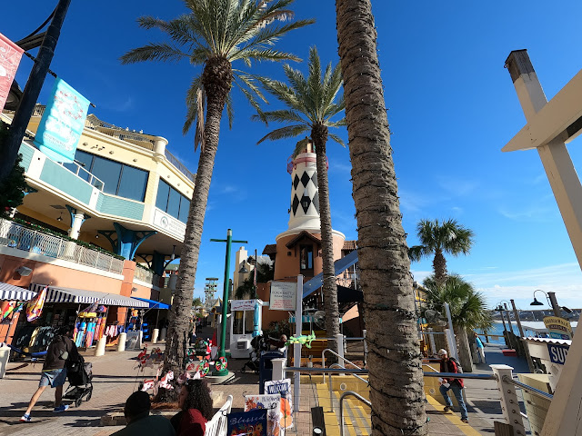 |
| Harbor Walk |
 |
| Margaritas |
 |
| Pensacola Beach to Destin |
TRAVEL DAY 151 - Destin to Pt. Washington
November 26, 2023
3.65 Hours/ 26.7 Miles
We woke to a steady rain and decided to stay put until 10 am and then proceeded to an anchorage at the end of Choctawhatchee Bay before the "Ditch" to shorten our trip to Panama City.
There was quite a chop on the bay as we rounded the corner from Destin and with overcast skies I navigated with the running lights on. Soon into the trip the rain that had dissipated returned. The waves were coming directly at us but at a period and size that wasn't uncomfortable. Halfway to our destination Choctawhatchee Bay flattened out but the visibility was lessoned with rain. I ran with the radar on.
 |
| Choctawhatchee Bay Bridge |
Less than 4 hours in, I throttled down and left the marked channel and slowly proceeded to the anchorage marked on the Navionics Chart. The anchorage was on the north side of the channel with a decent tree line affording us protection if the predicted north/northeast winds picked up. With about 5 1/2 feet of water and a mid incoming tide, I dropped the anchor and paid out a 7:1 rode of about 40 feet, then reversed the engine and planted the hook in the mud bottom. With the bridle on, we enjoyed the rest of the day in our quiet spot.
 |
| Destin to Vernon |
TRAVEL DAY 152 - Pt. Washington to Murray Bayou
November 27, 2023
6.06 Hours/ 52.3 Miles
The anchorage we thought would be perfect was not so perfect. The primary requirements for choosing an anchorage are, depth (calculating for any tide changes), holding (will the anchor set and stay set), swing room (a tide change can mean a 360 deg. swing around the anchor), wake protection (passing boats, tows, etc.), and wind protection (is it sheltered from the prevailing wind direction). I miscalculated the last. After midnight, the winds clocked around from the west, instead of the predicted north, and right in to our anchorage. The remainder of the night, the boat bucked up and down with the wind blown waves. Our anchor held well, it was just a little uncomfortable.
 |
| Choctawhatchee Bay Sunrise |
We did however wake to a beautiful sunrise in the east and a full moon to the west. Up early and anxious to get the boat on an "unbobbing" plane, we pulled the anchor early and headed to our next anchorage. I turned the boat east into the 18 1/2 mile ditch out of Choctawhatchee Bay that leads to West bay and Panama City.
 |
| Ditch |
We know we are back in Florida because now we are seeing so many derelict boats again. It seems that no other state we have been to has such a problem. Mostly sailboats but they are mixed in with a few power boats.
 |
| One of hundreds of derelict boats |
Passing Tyndall Air Force Base to our starboard, we turned port into our next (hopefully) safe anchorage for the night. With some daylight left, we did some emailing and dare I say "work".
 |
| Pt. Washington to Murray Bayou |
TRAVEL DAY 153 - Murray Bayou to Apalachicola
November 28, 2023
5.97 Hours/ 46.4 Miles
It was actually a nice change of pace traveling by ourselves but we missed the River Rats, and today we would see some of them at Apalachicola. We just had to get there first.
 |
| ICW to Apalachicola |
Being at anchor means getting a quick start to the day as the main task is only pulling the anchor and not untying an assortment of lines, unhooking shore power, storing fenders and lines. Giving the deck crew a break, I went on the foredeck to pull the anchor on a pretty chilly November day while the crew put the boat in and out of gear to facilitate. Once up, we motored out of the cove and back into the channel.
 |
| More derelict sailboats |
We were headed to Apalachicola, a favorite spot of ours as we move ever closer to home. This day also required a long stretch though another ditch. Close to the gulf beaches, but we couldn't really tell as we were back in the swamps and pines of the Panhandle. Through the next narrow cut ditch, past a small community called Overstreet, more ditch and past White City. At the White City bridge we noticed a nice park with a boat ramp and free docks. This looked like an excellent spot to stay a night through this section of water.
 |
| Apalachicola Railroad Bridge |
The last section of the ditch opened up to Lake Wimico, a broad lake with shallow water on each side of the channel. I noticed 2 trees and 1 tree stump in the channel and it reminded me of why you have to keep a vigilant watch and not assume that the channels are always clear.
 |
| Lake Wimico stump |
Almost to the end of the lake, the engine sputtered and died. I knew immediately it was the fuel. There are 2 fuel tanks on board, 1 port and 1 starboard. If we are not careful the boat will list to starboard as that side of the boat has a little more weight and a larger fuel tank. Overnight, the list caused most of the fuel from the port tank to transfer via gravity to the starboard tank. Even though we were low on fuel, we weren't technically out of fuel, the engine draws from both tanks and the port was empty. I should have shut the supply from the port off but I didn't. I immediately instructed the crew to deploy the anchor to keep us in the deeper channel and out of the shallow water. I then instructed the radio officer to call the oncoming boats on the VHF and inform them we were disabled in the channel. Now we had the task of restarting the engine. Diesels can be a pain to restart once they run out of fuel and that scenario should be avoided. I knew basically how to do it but just to be sure, I contacted a diesel mechanic friend. I am glad that I did as I also forgot 1 very important step. Close the seacock to the engine! A marine diesel should never be continuously cranked if it doesn't start. As the engine cranks, the water pump continues to pull water in, but it is the exhaust from a running engine that "spits" it back out. Too much water in without being expelled out allows the water to get back to the pistons and enter the engine. Then when the engine starts, catastrophe. To start the engine, I had to bleed all the air out of the fuel lines and injectors by opening the connection at the top of each injector and cranking the engine until all the air was pushed out and fuel came out. Once all the air was out, I tightened the fittings of all 6 injectors, cranked it again, and as soon as it came to life I opened the seacock. We were back on our way!
 |
| Apalachicola Shrimp Fleet |
As soon as we popped out at Apalachicola, we made a turn up to Scipio Creek Marina and filled the fuel tanks to ready ourselves for our Gulf crossing. Once we had fuel on, we went back down the creek to the Apalachicola Ice Company and our dock for the night, right behind Better Together. Reunited with some of our River Rats, we headed downtown to
Oyster City Brewing and the crews did some Christmas shopping while the Captains planned the next move to get across the Gulf of Mexico.
 |
| Apalachicola Ice Co. |
 |
| Pau Hana & Better Together |
 |
| Murray Bayou to Apalachicola |
TRAVEL DAY 154 - Apalachicola to Alligator Pt.
November 29, 2023
5.13 Hours/ 41.8 Miles
The weather looked good to stage our crossing. In the morning we all scootered to the grocery store in freezing temperatures to grab a few groceries. Back at the boat, we fired up the generator and the main engine and with the other River Rats we motored out of the Apalachicola River and into Apalachicola Bay, past St. George Island, into St. George Sound and past Dog Island.
 |
| Dolphins are always a treat (photo courtesy of Better Together) |
Many boats will either go up the Carrabelle River or anchor at Dog Island the night before crossing the Gulf. I noticed 3 Loopers the night before anchored near Alligator Point. Since the winds would be coming from the N/NE, this anchorage would be calm and shave 2 hours off of our crossing to Steinhatchee the next day.
 |
| Alligator Pt. Anchorage |
 |
| Sunset Docktales |
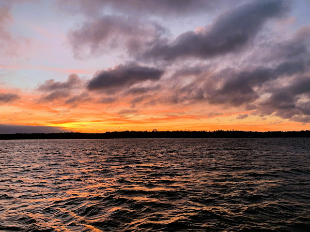
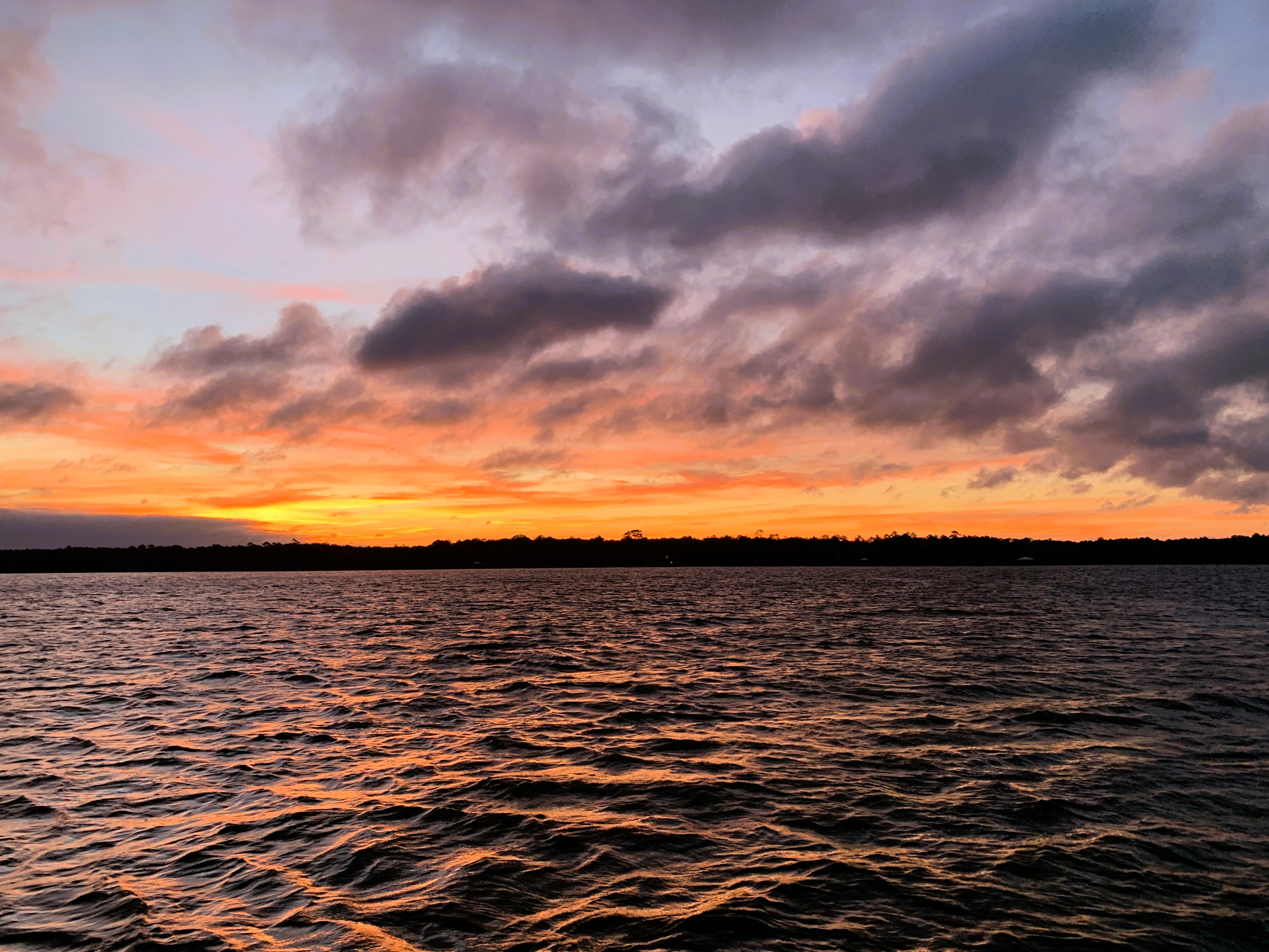
We dropped anchor near the beach in about 8' of water at St. Teresa and called Better Together over to tie to our port side. We had a great evening and cooked steaks on the grill discussing our long trip in the morning and what time we should depart. Our view gave us a stunning sunset.
 |
| Alligator Pt. Sunset |
 |
| Apalachicola to Alligator Pt. |


Comments
Post a Comment